
By Greg Rowe
The California Environmental Quality Act (CEQA) requires an Environmental Impact Report (EIR) to examine the potential impacts of a range of reasonable alternatives to the proposed project and evaluate the comparative merits of the alternatives. Under CEQA, the purpose of studying alternatives is to allow meaningful analysis and comparison of alternatives that could reduce significant environmental impacts as compared to the proposed project.
The alternatives must be feasible, meet most or all of the project objectives, and avoid or substantially lessen one or more of the project’s significant impacts. Alternatives are generally evaluated in a qualitative manner rather than to the same degree of exactitude as the proposed project. A “no project” alternative is always included. The “no project” alternative for a project that would develop vacant land would in most cases be the “Environmentally Superior Alternative (ESA),” but not building the project would fail to achieve any of the project objectives.
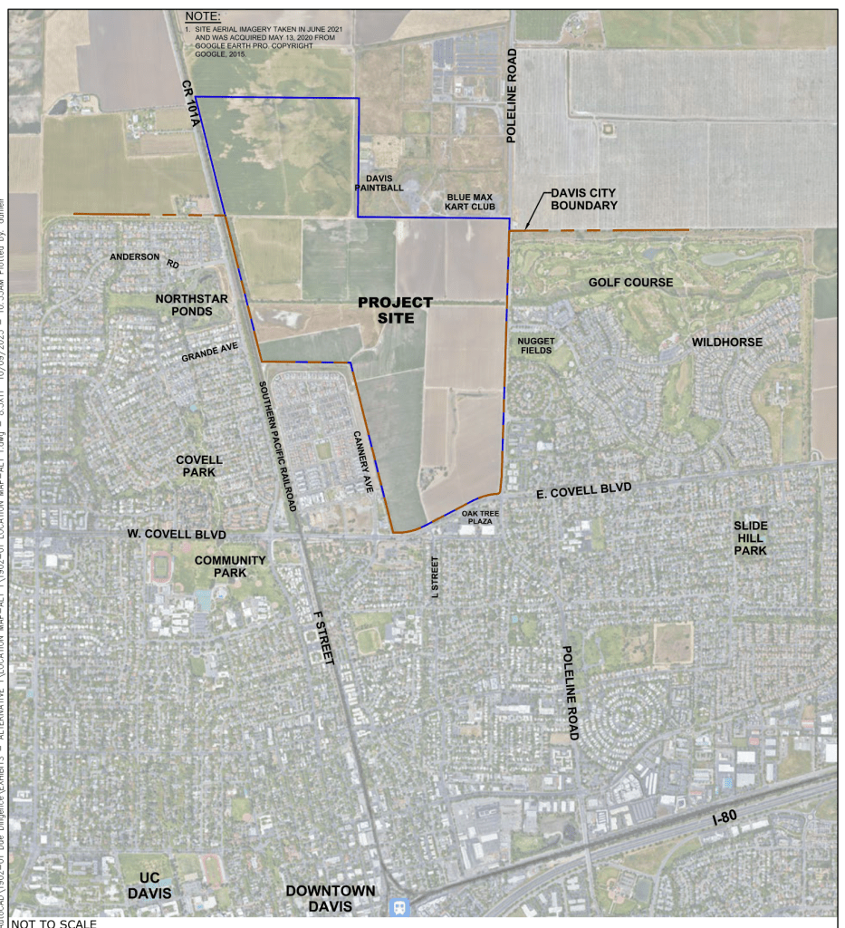
As a result, the alternative that best avoids or mitigates the most impacts is typically identified as the ESA, but the lead agency (the City of Davis in this case) is not obligated to substitute this alternative for the proposed project. In fact, because alternatives are generally analyzed qualitatively, a lead agency could not approve an alternative consistent with CEQA unless that alternative was also analyzed at the project-specific (i.e. detailed) level, such as the Biological Resources Preservation Alternative (BRPA) for the Village Farms project.
Alternatives are selected after the project’s impact analysis has been completed and the project’s potential impacts to the environment are known. This is a logical sequence because it is impossible to know if an alternative would produce fewer impacts if the potential project’s impacts are not yet revealed, just as a doctor cannot consider alternative treatments for a patient before the ailment and its source are known.
In my experience working with EIRs since 1984, once the impact analysis has been completed, there typically will be a meeting among the EIR consultant, the client (in this case, the City of Davis) and potentially the project proponent (in this case, the developer). For a project such as Village Farms, the EIR consultant and city planning staff would use their professional experience and knowledge of the area and CEQA to devise a range of reasonable alternatives, with which the project proponent may or may not concur. In other words, the selection of alternatives is an objective process based on impartial judgment and professional experience. It should not influenced by political or financial considerations.
A knowledgeable but now retired land use consultant once told me that in his long experience, impacts to biological resources, traffic, and air quality tend to be the primary factors that influence the identification of alternatives. Typical alternatives might include any or all of the following:
- The same footprint or area but with fewer units (meaning lower density).
- A smaller physical footprint but with the same number of units, which would typically avoid impacts on sensitive biological resources on the property.
- A reduced project area footprint that includes the same number of housing units, but with a different mix of housing types.
- A lower number of housing units on a smaller footprint.
- Developing the project at an entirely different location, if acquiring such land for an alternative is feasible.
